|
|
|
Getting
to Fairbanks
Traveling
the Alaska Highway
Not too long ago, it was only the hardiest of pioneers and gold-fevered prospectors that dared brave the wild and largely unknown region stretching between Western Canada and Eastern Alaska.
Thirty days on a pack mule train, or running a dog sled negotiating dangerous mountain passes, fording glacially fed streams and rivers, traveling through awe inspiring wetlands and estuaries, and majestic forests towering to the skies.
How must it first have appeared to those early travelers, the majestic mountains, the churning unbridled streams and rivers, and wildlife at every turn of the road?
|
|
|
|
If you're anything
like me, more than likely you and your family have seen several nature programs
on PBS showcasing life in the Yukon and Alaskan wilderness. In one of these
30 minute programs you might have seen the life cycle of a pacific salmon, bighorn
sheep, or even grizzly bears.
While this
does make for some memorable viewing, the reality is that the area we are talking
about is over 1500 miles long and about 1000 miles wide roughly the size of
New York Pennsylvania, New Hampshire. Conneticut, Massachusetts Rhode Island,
Vermont and Maine combined This area Literally crossing three time zones, four
temperate zones, and rising from near sea level to almost 5000 feetabove sear
level. The truth is that even if PBS had a hundred nature documentaries on the
wild life of this region you still would not be able to see all that is out
there.
The best news
is that you can go out there and experience all that is out there for yourself
for a fraction of what it would cost you to vacation in Europe, the Caribbean,
or Asia. And let me tell you here and now there is nothing like experiancing
nature in all its glory first hand.

In creating these pages it is not my intention to give you an exhaustive guide on where you can expect to see what along the Al-Can, or for that fact list out for you all the points of interest there are several fine books that do all that already.
Instead what I'd like to do is give you a feel of what this place is like, what kind of services you can expect along the travel route, and a few pitfalls you might want to avoid.
The journey begins
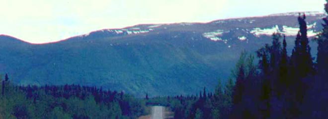
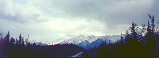
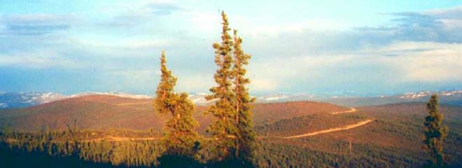
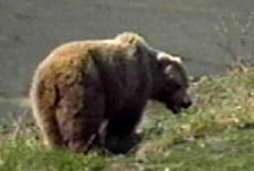
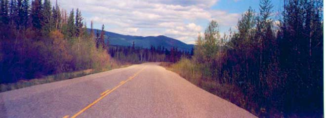
An old familiar adage states "Getting there is half the fun." And if ever that was true, it is for the traveler driving the Alaskan Highway to Fairbanks, Alaska. Passing through thousands of square miles of untamed wilderness along the way, no two trips are ever the same. With every turn of the road there's always something new to see, whether its wildlife grazing of foraging near the highway, or waterfowl in the hundreds of lakes, and ponds or the unparalleled natural splendor of seemingly endless mountains, streams, and forests.
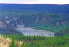
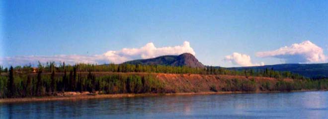
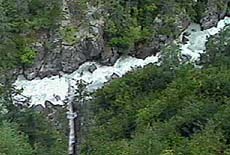
A segment of the churning Yukon River 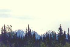
Just one view of an endless expanse of scenic vistas 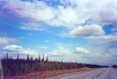
Once this was the site of a devastating Canadian forest fire. In a way as you travel this wilderness route you become a modern explorer. Just like Lewis and Clark of old you get this firsthand sense of the bigness of nature, and what is still out there. And while others may be content to see a few fleeting scenes on PBS in the comfort of their living room you will be one of the few that have reached out and touched it, literally having an experience of a life time. One can not take a trip like this and not be affected.
It's funny now looking back, at the time when we went up the Al-Can for the first time in 1994 we did it out of necessity (A partial ditty move US Army.) Having lived as an urbanite for most of our lives we had never seen anything like this and to tell you the truth we were ill prepared on the way out camera and film wise for what we saw.
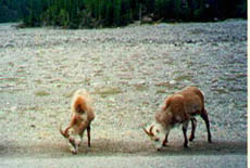
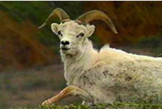
Wild Goats 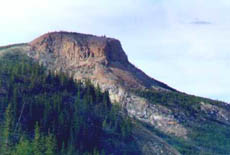
A Majestic Butte 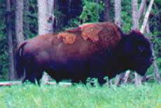
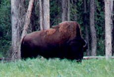
Another Bison However in the way back (Doing another Army partial ditty move) in 1997 we were ready! And armed ourselves with several cameras and a dozen rolls of film as we returned to the lower 48 to our next duty station (In Death Valley of all places.) Most of the pictures on this page are from our second trip. When we head up to Fairbanks in early september to live there I hope the weather will be cooperative and I can get some more nice photographs to add o this site.
Soon more photos 
A Brief History
Tourist information Centers
No other place that I or my wife has been in our life time sparks more interest in conversations then our having lived in Fairbanks, Alaska and our experiences driving the Al-Can Highway. And if you have pictures, WATCH OUT! Everyone wants to pore over them.
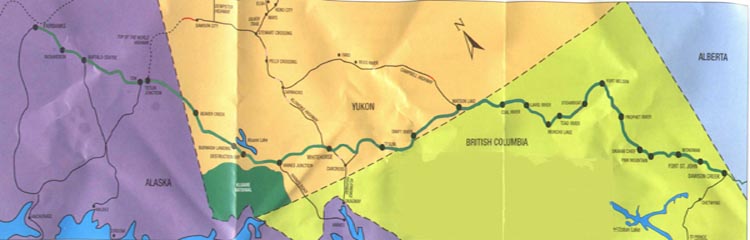
Highlighted in GREEN is Al-Can in it's entirety running west from Dawson's Creek, BC to Fairbanks, Alaska. If you're interested in looking at a larger version of this map or several others with greater detail you can do so by clicking ENLARGE MAP. And if you'd like to make a copy of any ofany of these maps for yourself please feel free to do so.
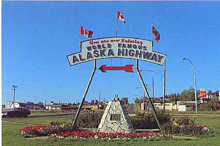
DAWSON CREEK
While the Alaskan Highway may officially begin in Dawson Creek, by the time most travelers have reached this remote Canadian town in British Columbia they've probably logged in the excess of a thousand miles already.
Actually if the truth be known for most people their trip the "Al-Can most likely begins in the city of Edmonton, in Alberta. The reason I say that is that from Edmonton on there is only one primary route that most everyone takes. So while it's not officially called the Al-Can in Edmonton from that point on the RVs Campers and U-Hauls you encounter on the road are probably all going the same place you're going. It's also not uncommon to travel in the same small caravan of vehicles for the entire trip.
Anyway once you see the famous "Mile Zero" Al-Can sign in downtown Dawson Creek you can rest assured that you only have a mere 1523 miles left before reaching Fairbanks Alaska.
To see a little of what all is in Dawson's Creek, and to see a partial list of sights and points of interest along the Alaskan Highway Click on the image above.
All along the way, regardless of the weather conditions, or what time of year you travel you will see many natural wonders, in this vast wilderness area spanning Alaska and Canadian. On my last trip on the Al-Can the sky was heavily overcast for most of the trip, but even so the photo's I took are spectacular none the less.
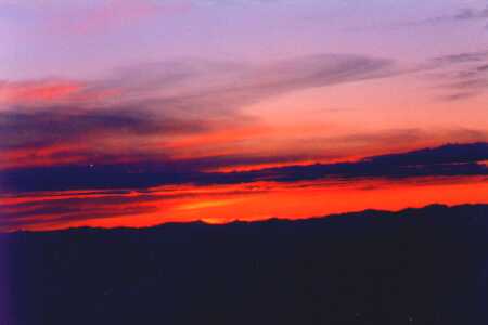
Sunrise on the AL-CAN
So when you do decide to go, make sure you bring your cameras and lots of film, you never know what you may see around the next bend.
As a small aside here, I will mention that many of the photos I've posted on this page were taken by me as I was driving on the Al-Can by just pointing my camera and clicking. You just just need to remember to keep your windshield clean, kodak moments tend to lose something when they're accompanied by squashed bugs and road dirt.
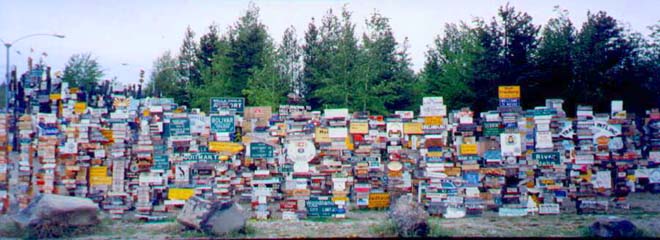
Watson Lake's SIGN PARK
In case you may have ever wondered where all of those missing street and road signs ended up, this may help answer that question. Covering almost a full acre in the center of the town of Watson Lake, this a park of sorts commemorating almost six decades of Al-Can travelers, without whom the Alaskan Highway would have all but disappeared after World War II.
It's hard to say how exactly this tradition got started but as you can see in this one small picture, this place is huge and contains tens of thousands "liberated" signs from community's all over the US Canada and around the world.
GOOD MORNING AMERICA
One funny thing that happened in the Summer of 1996 was the good folks from Good Morning America came out to pay Fairbanks a visit to do a 5 minute segment on Summer in Alaska. With all the Producers and resources they had available these people still managed to screw up by announcing on the air that the only way to get to Fairbanks, Alaska was by airplane.
Then in typical media style once they were confronted with the facts that there was something called the Alaskan Highway, that had been in existence for over fifty years they refused to correct on the air what was said. Needless to say quite a few people in Fairbanks had a whole lot to say about that on talk radio for a week or two.
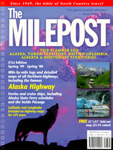
The Mile post
The #1 resource for traveling the Al-Can Highway is a book called "The Milepost."
To get a copy of this book or view other books on the Al-Can
Click hereIndispensable, this one of a kind book describes for you in detail mile by mile, road conditions, points of interest, and where you can get that all important food, gas, and lodging along the way. If you don't have a copy I strongly suggest you get one now, While you're still in the planning stages of your trip, that way you can familiarize yourself with the route you'll travel, and you'll be ready for those points of interest that you might otherwise miss along the way.
This meandering dirt strip is the American side of the Top of the World Highway
While The Milepost is indispensable, one of it's flaws is it seems to work from the mistaken notion that all the roads that lead to Alaska are more or less the same. That is more than likely due in part to the fact that it has many advertisers located along these less than desirable routes. So let me categorically state here and now that all roads in this neck of the woods are not the same! Especially if you're the average driver who's driving a motor home, dragging a camper, or pulling a U-Haul behind them.
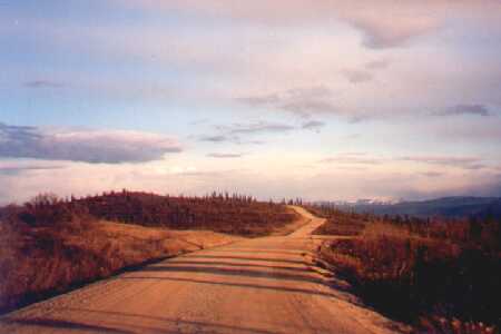
Would you believe this dirt road is a US Highway?
There are certain roads that can give you a heart pounding, gut wrenching experience like: Top of the World Highway, or taking the West Coast route from Washington State before hooking up with the main Highway in Watson Lake.
Regardless of whether your you are coming up from California, Oregon, even Washington State or from the Midwest of even the East Coast believe me, you don't want to get on the Al-Can west of the Rockies. Highway #-- is nothing but cliffs and precipices for hundreds of miles. You would be far better served to stay east of the rockies and try to enter the Al-Can from Montana or North Dakota and make a bee line for Edmonton. before heading west. While it may add a few miles to your journey, riding on relatively smooth level roads makes the trip a whole lot more enjoyable.
Unlike the undeveloped American side of the highway, on the Canadian side of Top of the World is broader, has shoulders, guard rails and is made of Stone Seal
TOP OF THE WORLD HIGHWAY
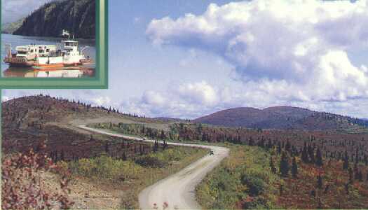
Finally you'll come to a place where the Al-Can splits off with something called "Top of the World Highway" The route looks shorter and there's this neat little ferry that will float you across the river but as soon as you cross the border to the American side the pavement ends and you're in for the ride of your life with hairpin turns, while meandering over the tops of mountains on a narrow dirt road with no guard rails or shoulders with scenic 200 foot drops, and no place to turn around. By all means by pass this.
When we mistakenly ended up on this cow path we saw a huge brand new 60' motor home with a Lexus being towed behind it had gone over the side of one of these 200 foot shoulder less cliffs. Lucky for the driver the entire camper and car were being suspended by these spindly pine trees and they were able to get out to safety. One day later after we crossed the Canadian Border and crossed the Yukon River by ferry to Dawson (Not Dawson Creek)
I was told by a service station owner that they were unable to get a crane up on the narrow road so that there were going to attempt to use two tow trucks from Dawson to try to pull this camper and car back on the road. And at the time he said that more than like likely both vehicles were going to end up as a total loss and have to be dropped to the bottom of the cliff.
One of many 200+ foot drops along the side of the highway 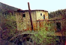
An abandoned Gold Dredge along Top of the World Hwy. 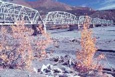
The longest bridge on the Al-Can
Road Conditions
On the Al-Can road conditions greatly vary from black top, stone seal, dirt and gravel. These road condition changes are not just in a particular County or Province but all along the highway for mile after mile. These conditions can be caused by rock slides, washouts, Frost heaves and permafrost damage. So you really do what to buy a copy of the Milepost and closely follow your progress mile by mile.
Good old blacktop on the American side of the Al-Can In Canada the they don't black top the highway, instead they literally spray tar on the dirt, on top of which they put a thin veneer of pulverized rock which they call "Stone Seal." As a road surface Stone Seal is quite impressive, however as soon as it starts to wear out its prone to potholes.
Stone Seal road surface on the Canadian side Another place is in the Yukon Territory about five miles before you hit ---- town there is this killer hill from hell if you are carrying any kind of a load you'll end up burning out a set of break pads on this one.
Best Driving Conditions on The Al-Can
Al-Can Driving
Jan. Feb. Mar. Apr. May June July Aug. Sept. Oct. Nov. Dec. Tourist Season NOTE: While the Al-Can is open year round winter driving can be risky if you ar not used to driving on ice and snow covered roads and sub zero tempertures dipping as low as 60 below zero. Cars have to have battery heaters engineblock heaters old pan heaters and must be plugged in at night or they will not start. Long stretches of road may not be ploughed all winder long so you end up driving on the snow pack. Many small gas stations are closed for the season so you need to bring with you gas containers with enough fuel to travel hundreds of extra miles. If you still want to drive the Al-Can that time of year get a copy of the milepost and make sure you know which gas stations are open year round.